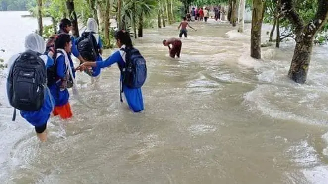
Several days of incessant rains have caused severe floods in the neighboring Indian state of Tripura. In this situation, the authorities have opened the dam of the Dumbur hydroelectric project, resulting in a huge amount of water entering Bangladesh. It is learned that the water of four rivers of Tripura is flowing above the danger level, which enters Bangladesh through the Howrah River through Tripura. As a result, several districts including Cumilla, Noakhali, Feni have been flooded.
Everything is being swept away by the flood tide; Public life has been disrupted, croplands have been submerged, and there has been a huge loss of life and property. Locals have already appealed for help. Earlier in 1993, the same dam was opened, which caused extensive damage in the Indian state of Tripura, including Bangladesh.
The magistrate of Tripura’s Gomati district warned on his official social media account that the water level of the Gomti river may rise further. Due to geographical reasons, Bangladesh, one of the lowest-lying countries in South Asia, is always at risk of flooding. The average elevation of the earth here is only 10 meters or about 33 feet above sea level. On the other hand, the height of the border areas of India is much higher than that of Bangladesh.
As a rule, the water flows from the higher reaches to the lowlands, making way for water to enter Bangladesh from the higher reaches of India. However, India is also affected by this disparity in height. Although the average height of India is a little more than 2000 feet, the height of neighboring Bhutan is about 3200 meters. Heavy rains in Bhutan also affect India, further complicating the flood situation in Tripura.
As a result of these natural disasters, both India and Bangladesh are now struggling to cope with the effects of floods, which have become more difficult due to the disparity in geographical elevation.


